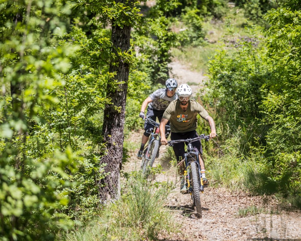
Mount Bosta trail area


Mount Bosta, in Lunigiana, serves as a watershed between the valleys of the Caprio and Bagnone streams, between the municipalities of Filattiera and Bagnone. For those cycling in the Lunigiana Bike Area, the Bosta peak is the landmark. Once reached it, it can be cycled up to the summit, which is about 900 meters above sea level, 4 different trails of varying difficulty lead back to the valley floor with almost 900 meters of negative height difference.
The itinerary presented here starts from the Tourist Information Point and Bike Center of Filattiera and returns there after about 25 km of pure enjoyment. The route is entirely marked with the number 6 and the color purple.
Setting off from the Parish Church of Sorano, route board, in the direction of Filattiera Paese, Gigliana and Biglio, first on a paved road and then on a dirt road suitable for vehicles. The trail enters the village of Biglio and continues uphill on paths until it reaches the Madonnina del Monte Bosta (Virgin of Mount Bosta), the highest point of the itinerary and the turning point.
From here, the route heads back down into the valley, taking advantage of the beautiful single tracks of "Vecchio Enry", "Fil di Cresta", "Renzhoffer", "Cà di Piola"; ancient paths that were once invaluable bridges between villages and are now a wonder for our wheels. The path is entirely downhill except for a short stretch connecting "Vecchio Enry" and "Fil di Cresta".
The Trails combine dirt flow sections with slightly more technical rocky climbs but without high technical difficulties for those accustomed to such trails, not to be underestimated, however, for people who are not too experienced in downhill technique. The trails are all of Blue level of difficulty on the IMBA scale with some short passages of Red level of difficulty. Here are the details:
Vecchio Enry
(Level of difficulty: Blue on the IMBA scale)
Distance 1800 m / Difference in height -195 m
From the slopes of Mount Bosta, it leads above the village of Lusignana, partially traced from scratch by LunigianaXbike. The first part is a single-track on a dirt surface, with changes in inclination, tight turns, sections on roots and possibility, avoidable, of dropping. In the final part, it becomes a double track where the inclination lessens. Perfect for having fun riding and improving the technique.
Fil di Cresta
(Level of difficulty: Red on the IMBA scale)
Distance 1700 m / Difference in height -210 m
The name indicates its morphology. The trail runs along a ridge set at the spur of Mount Bosta. The first part has some paths on rock thresholds, to be followed by copying or skipping depending on one's ability. The second part is on dirt, with a narrow trail that snakes through the trees. Throughout its length, it alternates between sloping and short uphill sections with some very satisfying viewpoints, to be enjoyed by taking a break.
Renzhoffer
(Level of difficulty: Green on the IMBA scale)
Distance 1900 m / Difference in height -117 m+78 m
The first part is uphill on a paved road followed by a middle part in single track consisting of fun and agile ups and downs where one can learn to manage the changes of inclination. The final section is a flow section with dirt surface all to ride, perfect for trying out new things.
Ca’ di Piola
(Level of difficulty: Blue on the IMBA scale)
Distance 3400 m / Difference in height -279 m
The longest of the Mount Bosta trails, it runs along an ancient mule track once used to connect the villages. Between ancient retaining walls and some sections that are still paved, we will alternate short technical sections with others that are very easy to ride. The perfect trail for a fun return to the valley, all the way to the village of Filattiera on one side and Filetto on the other side.