Montorgiali, San Giorgio and the Via Clodia


Montorgiali, a medieval village attested on a ridge overlooking the Fosso Inferno, is located on the route from Grosseto up the hills toward Scansano and Saturnia. A possession of the Republic of Siena between the 14th and 16th centuries, the earliest records of the town date from 1118.
Located opposite Montorgiali, the shrine of San Giorgio (St. George) consists of a small church on whose altar is a statue of St. George with the dragon. On April 23 each year, on the feast of the Saint, the village dresses up for the "Cavalcade of St. George", with yellow and red rosettes and drapes waving from windowsills as they adorn horses and riders. Songs of spring enliven the countryside in an atmospheric folk festival, which frames the religious celebrations.
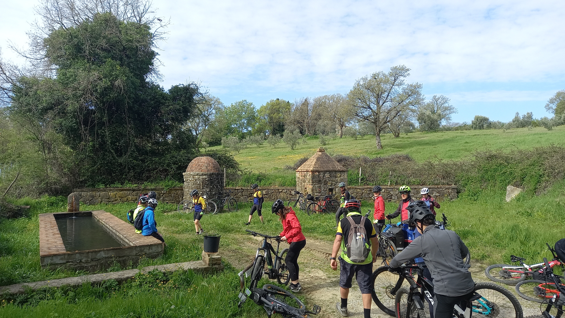
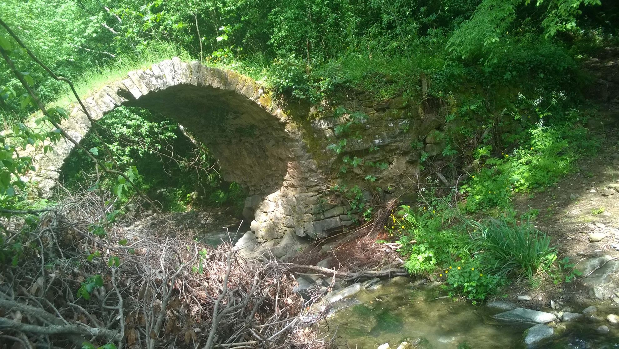
Let us start from the hamlet of Bivio di Montorgiali. Located less than 2 km from the village, the "Bivio" is on the SP 159 Scansanese road, at the crossroads between two ancient customs posts and the Via Clodia, of which remains, untamed witness, the Devil’s Bridge over the Fosso Inferno reachable by a path that connects the Montorgiali cemetery to the Bivio. One proceeds in the direction of Scansano along an old dirt-bottomed customs road that ends near the village of Pancole. Here, noteworthy are the cistern well in the highest square of the village and the spring of the ancient wash houses. We enter SP 39 in Polveraia, following it as far as the columns that marked the boundary of the properties of the Montepò Castle.
We enter the second gravel sector, which has fair downhill gradients and some cemented sections. The imposing silhouette of the Castle accompanies us until it disappears behind Poggio della Rustica, near Polveraia. On the ridge in front of the castle are the ten towers of the Poggi Alti Wind Park. The large blades rotate silently with every gust of wind and are capable of producing clean energy for the needs of 20,000 households.
Clear ruins of masonry works on a small hillock overlooking the Seine take us back to the Late Middle Ages, when the town of Cotone stood here, named after the noble Sienese family Cotoni-de' Maggi, which owned these lands since the 13th century with Monte Pò and Montorgiali.
We are now in the built-up area of Polveraia. After a restorative stop at the drinking fountain at the entrance to the village, we resume climbing SP 39 to continue on the consortium road that breaks off to the right of the provincial road near kilometer 7. From the little hill of Colle Fagiano, the panorama opens up to the coast with wide views. The next passage from the Perucci agritourism above anticipates the arrival at the plateau where the sanctuary of St. George stands.
The Devil's Bridge on the Via Clodia
Information on the existence of an appendix of the Via Clodia between Saturnia and Roselle is not always in agreement, and the possible route is lost in the network of small roads and customs that furrow the countryside. However, the Region of Tuscany has made its own an itinerary that finds in Montorgiali a point of safe passage, and in the ancient bridge over the Fosso Inferno the most significant monument. And so it is that, following the Via Clodia signs, we walk along the small road that descends to the single-arched medieval bridge, which seems to defy the passage of centuries, strong in the perfect joints of its stones. Given the high historical value of the artifact, visitors are requested not to climb onto the bridge and cross the ditch from the ford below. On the other side, the small road of the ancient Via Clodia continues to Bivio Montorgiali.